


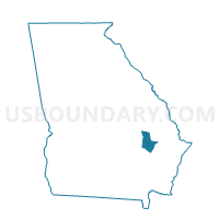
2676 - BIRDFORD Voting District, Tattnall County, Georgia
About
Outline

Summary
| Unique Area Identifier | 562908 |
| Name | 2676 - BIRDFORD Voting District |
| County | Tattnall County |
| State | Georgia |
| Area (square miles) | 33.72 |
| Land Area (square miles) | 33.20 |
| Water Area (square miles) | 0.51 |
| % of Land Area | 98.48 |
| % of Water Area | 1.52 |
| Latitude of the Internal Point | 32.01627100 |
| Longtitude of the Internal Point | -81.86772270 |
Maps


Graphs
Select a template below for downloading or customizing gragh for 2676 - BIRDFORD Voting District, Tattnall County, Georgia


Neighbors
Neighoring Voting District (by Name) Neighboring Voting District on the Map
- 1095 - DAISY CITY HALL Voting District, Evans County, GA
- 1097 - BELLVILLE Voting District, Evans County, GA
- 17913 - BUTTON GWINNETT Voting District, Liberty County, GA
- 1831 - BEARDS CREEK Voting District, Long County, GA
- 2677 - EAST GLENNVILLE Voting District, Tattnall County, GA
- 2678 - DISTRICT IV Voting District, Tattnall County, GA
Top 10 Neighboring County Subdivision (by Population) Neighboring County Subdivision on the Map
- Hinesville CCD, Liberty County, GA (52,662)
- Glennville CCD, Tattnall County, GA (10,916)
- Ludowici North CCD, Long County, GA (8,866)
- Claxton CCD, Evans County, GA (7,878)
Top 10 Neighboring Place (by Population) Neighboring Place on the Map
Top 10 Neighboring Unified School District (by Population) Neighboring Unified School District on the Map
- Tattnall County School District, GA (25,519)
- Evans County School District, GA (11,000)
- Fort Stewart School District, GA (9,385)
Top 10 Neighboring State Legislative District Lower Chamber (by Population) Neighboring State Legislative District Lower Chamber on the Map
Top 10 Neighboring State Legislative District Upper Chamber (by Population) Neighboring State Legislative District Upper Chamber on the Map
- State Senate District 1, GA (184,711)
- State Senate District 4, GA (182,797)
- State Senate District 19, GA (161,882)
Top 10 Neighboring 111th Congressional District (by Population) Neighboring 111th Congressional District on the Map
Top 10 Neighboring Census Tract (by Population) Neighboring Census Tract on the Map
- Census Tract 9503, Tattnall County, GA (5,744)
- Census Tract 9702, Evans County, GA (3,989)
- Census Tract 9703, Evans County, GA (3,889)
- Census Tract 101.02, Liberty County, GA (2,297)
- Census Tract 9800, Long County, GA (0)